


LaunchPoint SiteRight app for iPhone and iPad
Developer: ELM FieldSight
First release : 14 Apr 2019
App size: 141.31 Mb
SiteRight collects precise GIS field data using customized Forms, project specific Data Dictionaries and map-based data capture tools
• Data is safely stored in the cloud for later use in reporting, analysis, or any project management process
• Export your captured data to other enterprise GIS and work management systems
• Generate comprehensive reports with GPS-tagged multimedia
• Custom workflow triggers, and real-time notifications and alerts
• Organize data and users with group and role-based assignments
GPS Survey combines precision mapping capability (GNSS and survey-grade) to visualize, share and export GIS data across your organization
• Create customized forms and define data dictionaries specific to each project
• Define geometry types and map symbology
• Assign exact location-based tasks to users
• Visualize, manage project status, and assign tasks from the data map
• Edit points and line connections live in the app during collection
• Export the data to GIS file formats or publish to the ArcGIS Cloud
GIS Survey creates digital pipeline inspections, including gas leak, atmospheric corrosion, cathodic protection and more. Enrich your data with precision location services. SiteRight is now compatible with the BAD ELF GNSS SURVEYOR providing high accuracy digital trails, enhanced form accuracy, and precise multimedia location data. Easily verify remote inspections with virtual auditing.
• Optimized technician routing and project task tracking
• Assign task areas and follow up inspections with precise locations
• Verify and audit project progress with digital trails
• Create customized workflow logic unique to your business
• Get notified with real time alerts and notifications
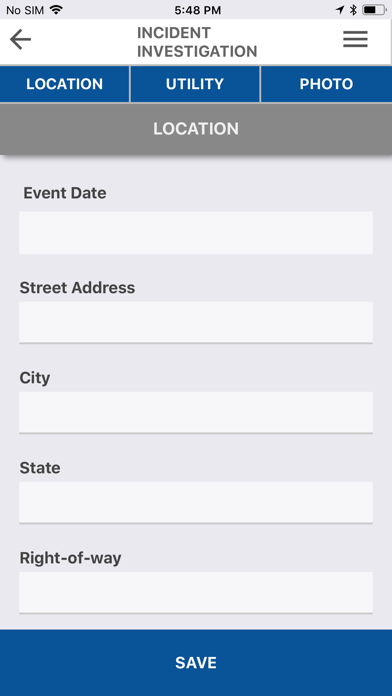
Incident Investigation collects GPS-tagged photos, videos and map sketches with notation
• Walks a user through the collection of incident questions and facilities capture of comparison photos from original site status detail
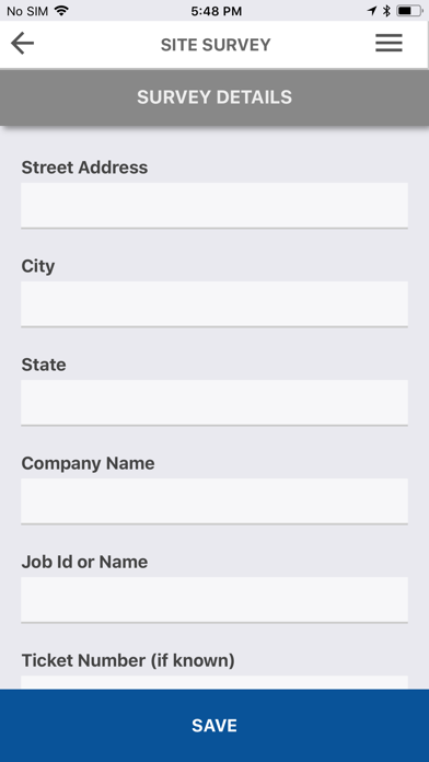
Site Survey documents work site in detail prior to a project start
• Collect GPS-tagged photos, videos and map sketches with notation
Custom Forms to create mobile field forms customized to any collection needs
• Define data dictionaries and field types
• Create customized workflow logic unique to your business
• Organize forms into user-groups and assign user access roles